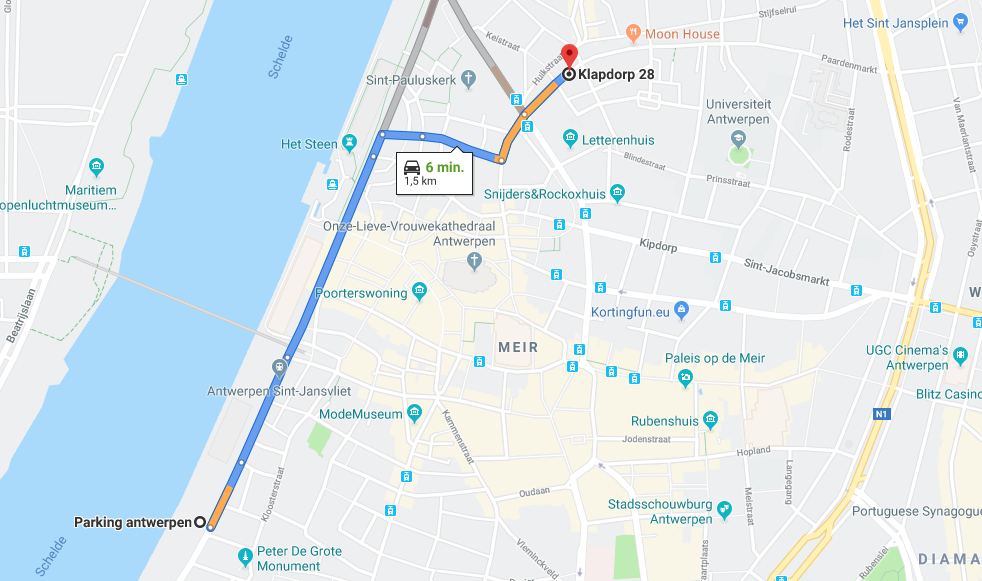
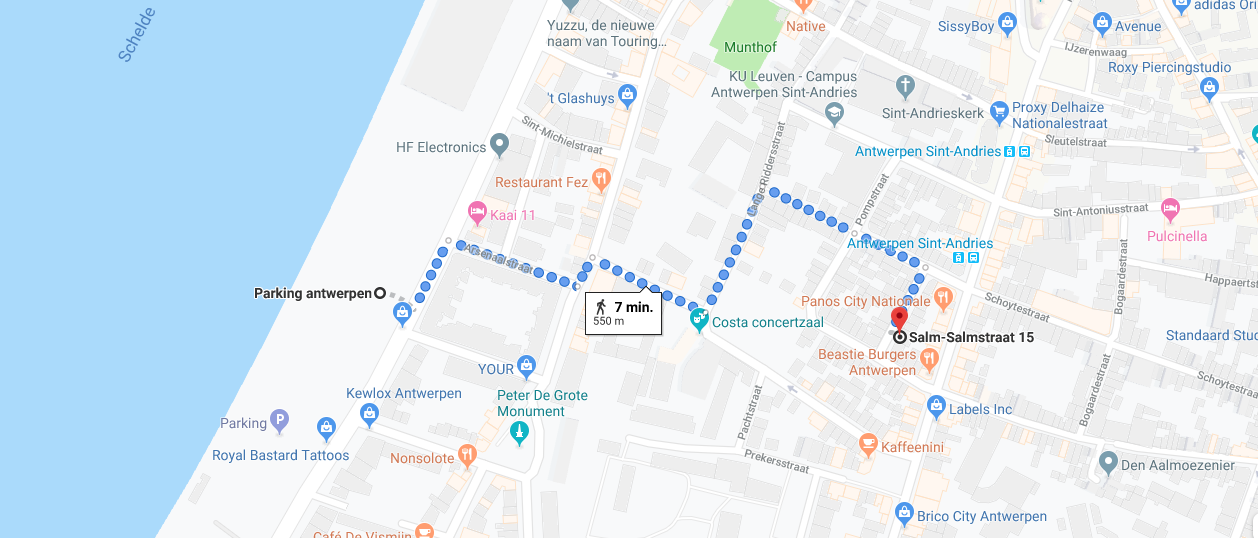
Parking
Parking near the house: look for vending machines to pay the place
On the city map you can immediately see which rate applies where and at what times you pay or have to place a parking disc. On the street you will also find the tariff information on the signs (including vending machines, parking information signs, traffic signs).
Parking zones and rates
Antwerp has different tariff zones in the city center and districts.
It’s Red zone
Paid parking from Monday to Saturday from 9 am to 10 pm.
Maximum 3 hours of parking.
1st hour: 1.60 euros, 2nd hour: + 2.70 euros, 3rd hour: + 3.80 euros
Free parking:
Sint-Michielskaai 13-15, 2000 Antwerpen
From: Antwerpen, Salm-Salmstraat 15
From: Antwerpen, Klapdorp 28

__________________
Car doesn’t apply to the low emission rules in Antwerpen:
If you consider to come to Antwerpen with the car, but you car doesn’t apply to the low emission rules, you can use one parkings outside the Antwerpen “Low emission” area. We have also sufficient public transport lines to get easy to our place
If you will be making a longer visit to Antwerp for work, shopping or as a tourist, you can park your car easily and at no charge in one of the park-and-ride (P+R) sites on the city fringe and transfer to the tram, bus or bicycle. From the P+R site, you will have a quick connection that will take you to the city centre.
Plan your route above. Do you want to know more about how the route planner works?
Is my car allowed to enter the LEZ?
________________
Public Transport in Antwerp
The Closest bus stops Near Klapdorp street:
Tram 7 – Station Antwerpen Klapdorp
Bus 17 – Antwerpen Hessenbrug
The Closest bus stops Salm-salm sraat 15 street:
Bus 180, 181, 182, 183, 22 – Antwerpen Sint-Andries
Tram 4 – Antwerpen Sint-Andries
You can always use the public transport its 3 eur per hour, it means you can change transports from tram to bus or bus to bus with one ticket during 1 hour. Here you can see the scheme of a trams and busses.
Public transport route planner
Tip: If you found difficult to use a “Public transport route planner “Google maps” also provides time table and routes also for tram trains and busses
If you want to use any other means of transport BIKE / SCOOTER / TAXI

